Exploring the History of Sapporo’s Roads
Let's Walk!
Learn about the history of Sapporo's roads
From Ezo to Hokkaido
In ancient times, the Jomon people lived in Ezochi and formed a unique culture with the Ainu people who moved from the north, east, and south, forming the Ainu culture as an indigenous people. Later, it is said that the Japanese (Japanese) people settled in Ezochi around 1300 B.C. Around 1700, the Edo shogunate took control of Ezochi, and the Matsumae clan ruled the region. It was not until 1868 (Hokkaido), when the new Meiji government began to develop Ezochi in earnest.
Hokkaido’s Settlement and the Sosegawa River
Hokkaido was developed by the Meiji government. The Kaitakushi (government agency) was in charge of the development of Hokkaido, and the Tonden system was established, with Tondenhei (soldiers in times of emergency and farmers in times of peace) and other pioneers gathered from various clans throughout the country. Even today, the name “”Tonden”” still remains in many places.
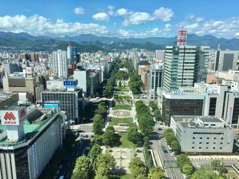
First, Sapporo was chosen as the main government of Hokkaido, and the nearby port of Otaru flourished with people and goods as a port of shipment. Then, the development of Sapporo began. The route was to leave Otaru Port, enter the mouth of the Ishikari River, and proceed inland, where it would be transported by man and horse. This is the Sosei River today.